
A walk to the Ness of Burgi, South Mainland

Sign up to Newsletter:
* Indicates required field
Email *
I agree to receiving marketing and promotional materials
*
Ness of Burgi fort with Sumburgh Head in the background
Last weekend we visited Sumburgh Head and the fantastic new Unken Caffee. With commanding views out to sea and north across the South Mainland, it got me thinking about how past people lived and about the architecture, defensive or otherwise, that they built here.
Shetland’s South Mainland, at one time, was a highly fortified area. If we rewind about 2,000 years to the Iron Age and place ourselves at Sumburgh Head, the landscape would have been very different and, likely, quite intimidating.
At Sumburgh Head, where we stayed, an Iron Age fort, now lost to history, stood proudly on the headland. The next prominent headland to the southwest is Scatness and, right at the point of this headland sits the Ness of Burgi, the subject of today’s walk.
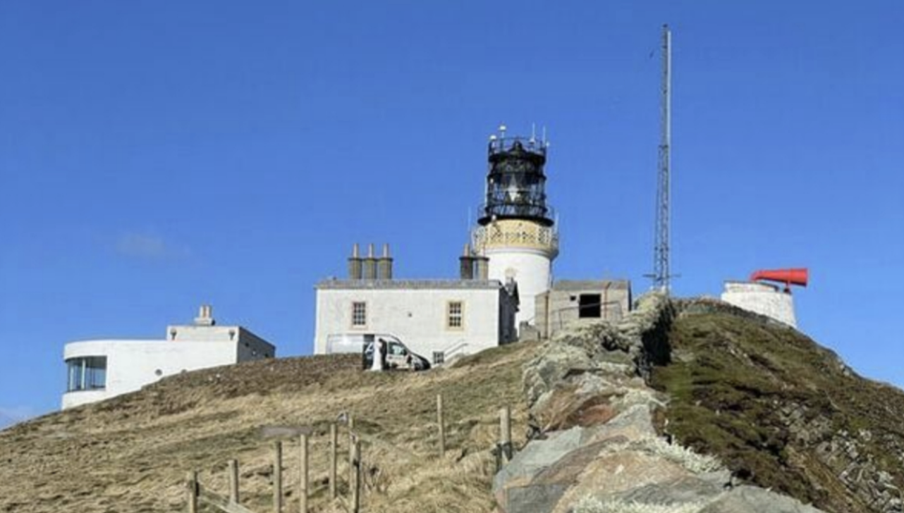
The Unken Caffee is the glass-fronted building on the left with views out to sea. Behind this is Sumburgh Head Lighthouse, a working light, operated by the National Lighthouse Board.
Views from the Unken Caffee. Sumburgh Head looking North towards Jarlshof
To get to the Ness of Burgi
Follow the A970 south to Sumburgh (or north if you’re approaching from the lighthouse!), take the turn for Scatness and park at the end of the road. Please ensure that you don’t block the turning point or impede private access tracks.
Distance: 2 miles (3.25 km)
Time: 1 hour
Accessibility: This is a relatively easy walk with one trickier section over rock (a handrail is provided)
To begin the walk, pass through the gate and follow the rough grassy path towards the headland.
There is a fantastic example of a drying kiln at the very start of the walk on the end of one of the stone buildings. Kilns were used for drying grain and acted as a giant chimney, allowing smoke to escape and pass through the grain to dry it. The South Mainland has many fine examples of kilns, including one at the Crofthouse Museum. The south’s sandstone meant that good building stone was readily available, so the buildings’ architectural features tend to be better developed. In the north, where rock is more volcanic and irregular, we see fewer features such as kilns.

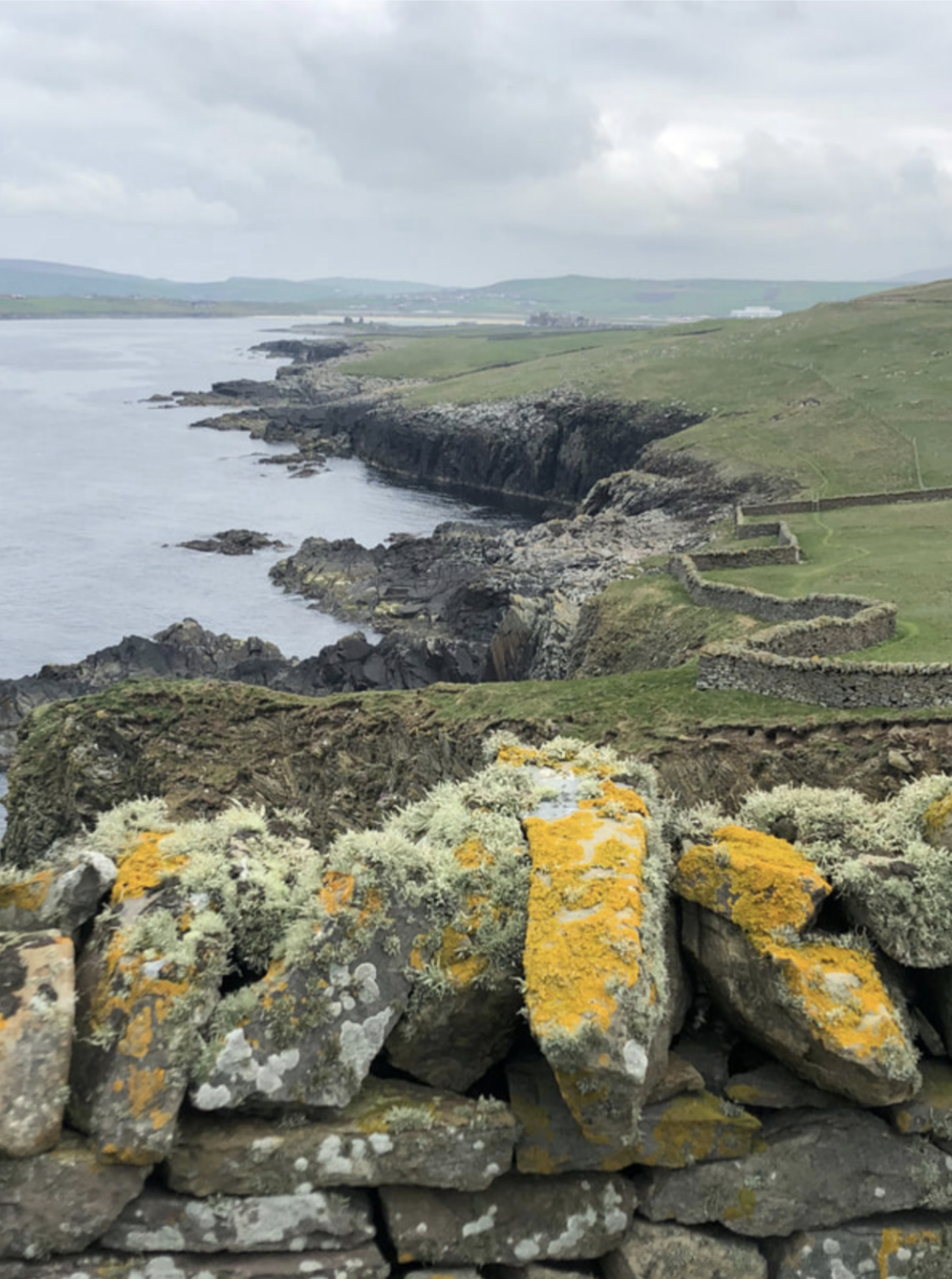
Turquoise water with Fitful Head shrouded in mist in the background from the Burgi peninsula
As you head towards the headland, the peninsula narrows and the ground becomes uneven and rocky. From here, there are excellent views on either side of Fitful Head and Sumburgh Head.
The mid-section is the most challenging part of the walk across a rocky, worn section of the peninsula. There is a handrail to assist with the ascent and descent, but the rocks are roughly hewn into steps which definitely helps!

The rocky mid-section of the walk with a handrail to assist access to the site


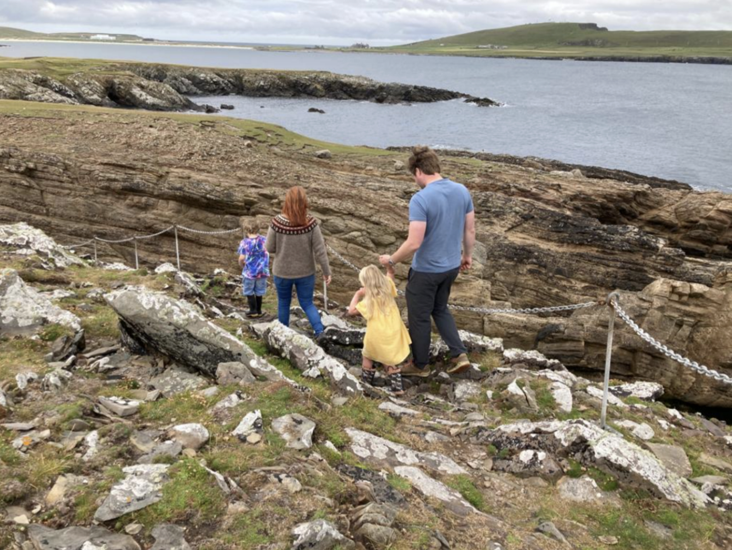
Photo: Marian Armitage
Once through this section, the peninsula opens out and widens again, and you are back on a grass path once more. Continue along the headland until you reach the Ness of Burgi Iron Age block fort at the tip of the headland.
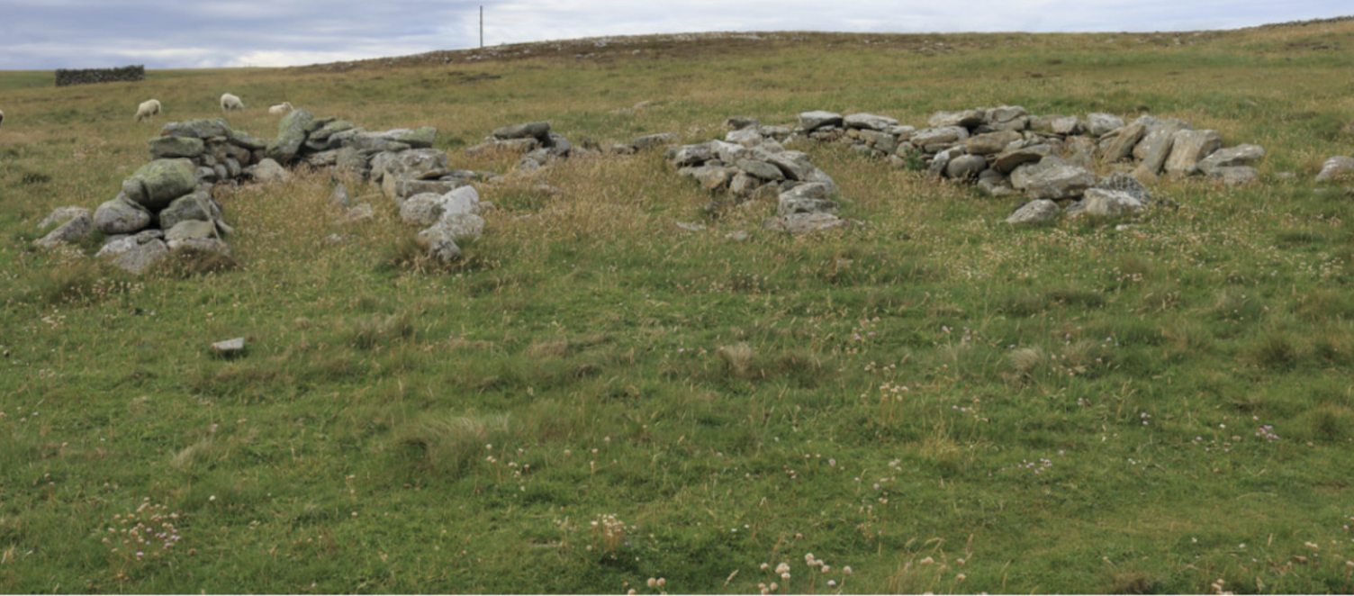
The name itself tells us what to expect here – Burgi comes from the Old Norse word for borg, meaning fortification.
This fort is one of at least three block forts known to have been in Shetland during the Iron Age. Other examples are found at Clickimin Broch and in Whalsay. Ness of Burgi is about 2,000 years old and contemporary with the brochs. The fort itself is about 23m by 5.5 with walls that today stand at about 1.5 metres high. The fort has a central passage and two large chambers to the north and south.
These forts, and brochs in general, remain a bit of a mystery of the Iron Age. Archaeologists still have no idea what these compelling buildings were built for. Were they defensive or offensive? Were they homes or perhaps grain stores? We will never truly know. One thing is clear; our Iron Age structures were inter-visible.


Ness of Burgi fort
As mentioned above, this was a highly fortified area; not only were there the forts at Burgi and Sumburgh Head but several brochs nearby, including at Jarlshof, Old Scatness, Eastshore and Toab. It’s entirely possible that these were part of a network of fortifications that could act as early warning systems, sending smoke signals to warn of impending danger. This early warning system was not confined to Mainland Shetland; there was an Iron Age fort on the island of Fair Isle to the south. From Fair Isle, Orkney is visible, and from Orkney, the Scottish Mainland comes into focus. Is it possible that Iron Age Scotland had a highly advanced communications network that reached right up through Shetland?
Beyond the peninsula lies Horse Island, which features in the first written records referring to Shetland in the
Orkneyinga Saga.
In this, a poor penniless farmer is accompanied by Earl Rognvald in disguise on a fishing trip.

Horse Island from the Ness of Burgi

This is an important reference from the 12th century. It gives us a brief glimpse into the lives of the people who lived here, and it tells us, as we still know today, that this stretch of water, where the North Sea meets the North Atlantic, between Sumburgh Head and Fair Isle is extremely dangerous.
Boat noosts. These were used for hauling up boats to safety during the stormy winter months
This is a fantastic walk, and, especially at this time of year when the wind is still biting, it’s short and invigorating! On another walk here, on the way back, we followed the coast around to a small beach where we discovered old noosts, used for hauling boats into over winter, and the bairns found themselves in the sea, giving me one of my favourite photos of the summer of Lena.

Looking for creatures in the shallows
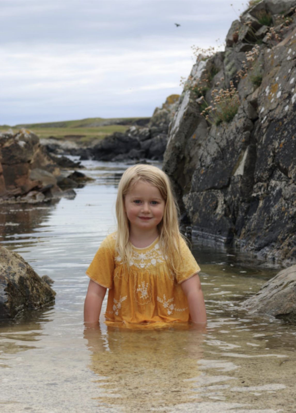
A contented Lena after a walk to the Ness of Burgi
Until next time,


