
A walk to the Burraness Broch, Yell
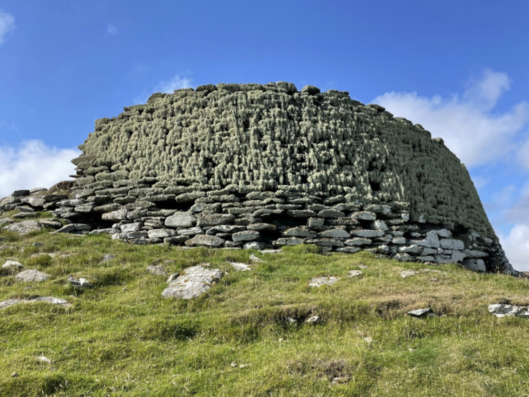
Burraness Broch, Yell
For visitors to Shetland, there are usually several requirements on their wish lists, including; scenery, wildlife and archaeology. The following walk is a fantastic way to explore all three of these on a moderate three-mile walk.
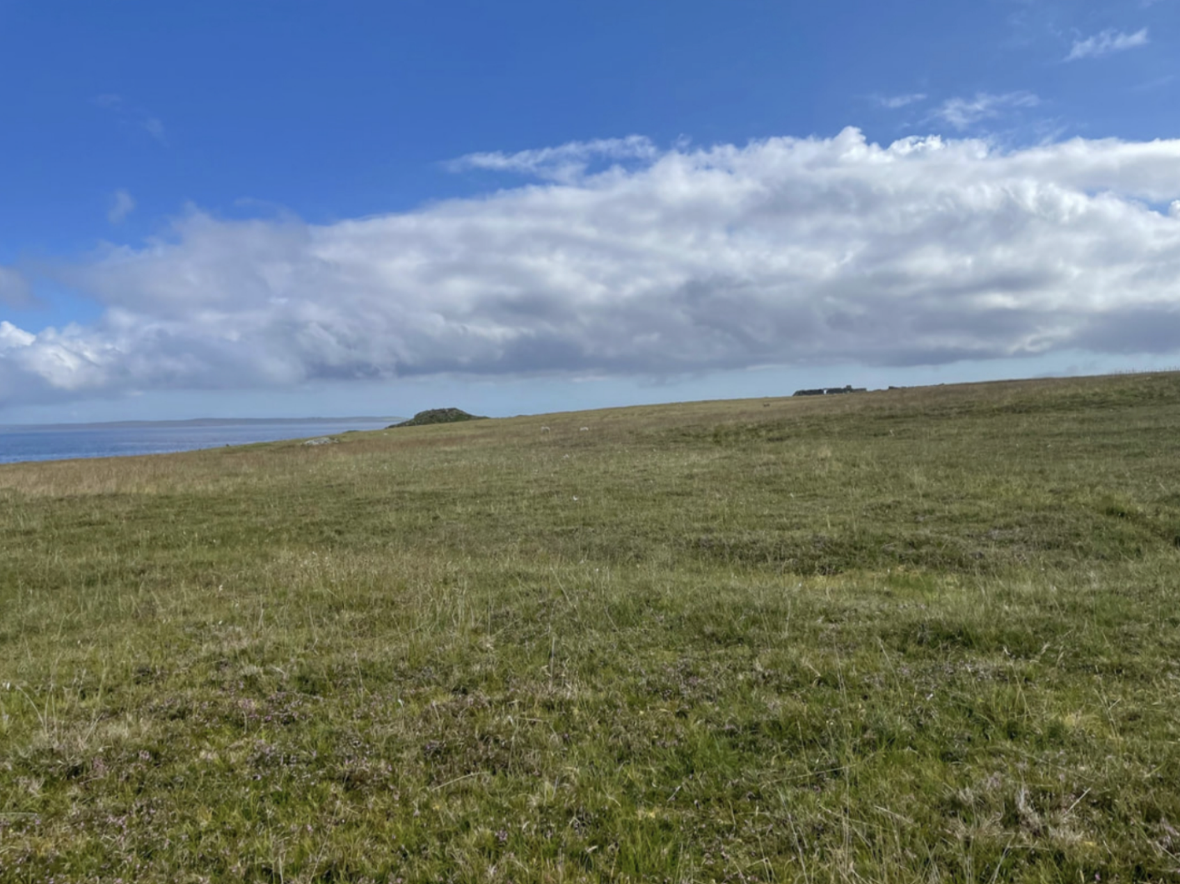
For this walk, we walked to the Burraness Broch on the island of Yell. Yell is just a short hop across Yell Sound on the modern inter-island ferry. The crossing takes about 15 minutes, and passengers can stand on the upper deck, enjoying panoramic views across the sound, past the uninhabited islands of Bigga and Samphrey. Yell itself is around 17 miles long and seven miles wide, boasting large expanses of uninterrupted moorland, stunning beaches and breathtaking coastal walks.

Beautiful coastal scenery of Yell. Sands of Breckon.
The destination – Burraness broch – is one of about 120 known broch sites in Shetland. But what is a broch? Brochs are unique to the north and west of Scotland and, in simple terms, are round, stone structures constructed using two drystone walls – an inner and outer – with a staircase built between the two, reaching the top. They date back about 2,000 years to the mid-Iron Age, and there was a high density of them throughout Shetland – predominantly on coastal locations. Archaeologists still dispute what they were used for and whether they were defensive or offensive. Were they storehouses, or were they the high-status homes of local chieftains? Perhaps they were community hubs? We don’t know. All that we can be sure of is that they remain shrouded in mystery and still, to this day, leave archaeologists scratching their heads for answers.
Burraness, like most of the brochs in Shetland, stands in ruin, unexcavated and free from the grasps of mass tourism. There is no signage, no entrance fees, no glossy interpretation panels, no visitor centre and, on the day we visited, nobody else was there other than a few grazing sheep.
Burraness Broch, Yell, with not a sign of anyone for miles around, other than a few sheep.
Walk description
Distance: 3 miles (5km)
Time: 2 hours
Rating: Moderate
---
Peering at the map, I couldn’t decide which way to tackle this walk – should we walk in from the ruined house at Kirkabister (at the end of the Cunnister road), or, take the more popular route, parking at the end of the North Sandwick road, just a short distance from the Gutcher Ferry Terminal?
Indecision is something that plagues me – I hate the thought that I might miss ‘something worth seeing’ so, with that in mind, we opted for a two-car approach – a luxury that most visitors don’t have – leaving one at Kirkabister and the other at North Sandwick so that we could walk the entire Burraness peninsula. But, before you sign out and decide this walk’s not for you, don’t worry, you’ll be glad to learn that having done the walk, I don’t recommend taking this approach – I now know how this walk works best.
So, my recommendation – having done the whole peninsula – is that you park the car at North Sandwick and follow the coast around to the broch before turning heel and heading back the way you came. I’ll write this blog as though we walked there and back from North Sandwick.
*Please note that there is no designated parking area here so please park responsibly and draw-in by the stile without obstructing other drives, livestock gates or obstructing the small turning point.

Access route from North Sandwick, Yell towards Burraness Broch.
This is a three-mile walk and, if you want to explore further and see more of the headland, that’s great. Still, I would recommend tackling it from North Sandwick rather than Cunnister as the seascapes are more breathtaking, and there are two large expanses of sandy beach to explore on the way – you might even fancy a dip to cool off?
From the car, walk down to the beach at Sandwick itself, where the ruined remains of a 19th-century house overlook the picturesque sand. This building was the Haa of Sandwick – a house generally associated with the ruling classes or lairds.

Sandwick Beach with the ruined remains of a house overlooking the beach.
From here, follow the coast south – you’ll see the area marked on the OS map as Burra Ness. It’s not a requirement to bring an OS map, but I find that they are helpful to carry as you can look out for any landmarks in the area or placenames that might give clues as to the land use in the past.
Following the cliffs, it’s not long before you drop back down to sea level, following an old track that has now grown over but provides a flat surface to walk on. The old path leads down to another sandy bay overlooking salmon farms out in the sound beyond. Behind the beach, a silty loch has formed, providing a good spot for birdwatching.

Visitors to Burraness are treated to not just one, but two beautiful sandy beaches.

These guys managed the walk and, although they're both good walkers, I'd say it's fairly child-friendly!
Carrying on beyond the beach, the ground is flatter, and the cliffs give way to stony boulder beaches. Follow the coastline and look out for the boat ‘noosts’ carved into the landscape. A noost is a place (usually a hollow) where boats were hauled up in the winter to protect them against the winter storms. These were used in Shetland from Viking times, right up until the mid-20th century – in fact, you still sometimes see boats hauled up in noosts today, although it’s less common.

Boat noosts are a reminder of times past. These hollows were used for storing boats over the winter to protect them from winter storms.
Arriving at Burraness broch is inspiring; you’re first greeted by ditches or ramparts carved from the earth and surrounding the structure of the broch. It appears as no more than a mound on the headland from the landward side, but as you walk around and view it from the seaward side, it seems much more grand and imposing.
Today it stands at several metres high, although most of the structure has collapsed in on itself. That said, you can still see the original walls and get an idea of the double-wall construction that is so synonymous with Scotland’s brochs.

Burraness Broch has commanding views out to sea.
The broch itself has commanding views out to sea towards the island of Fetlar to the southeast, Unst to the northeast and the isle of Hascosay to the south. One suggestion is that brochs were used as a kind of early warning network, sending smoke signals to each other if danger loomed on the horizon. Shetland’s brochs are generally all intervisible, and most brochs are in sight of another. Burraness is in view of Sna Broch in Fetlar, which, in turn, looks southwest towards Yell and the broch at Gossabrough, and so on …
From our lookout position, we enjoyed a picnic of tea, cake and sandwiches and watched the gannets and terns dive in the sound beyond before heading back towards the car.

A brew with a view.
We thoroughly enjoyed our walk - and I hope you did too!