In the Garden of Shetland: a foray through Fetlar (part two)
A still evening at Aith, Fetlar, skimming stones in the water.
A still evening at Aith skimming stones in the water.
We recently spent a few nights in Fetlar, endearingly known as The Garden of Shetland. In anticipation of the schools going back, and trying to make the most of the time we had left of the holidays we booked the Aithbank Camping Böd, former home of storyteller Jeemsie Laurenson. The weather was glorious and Fetlar shone, like a glistening jewel in the North Sea, giving us the best it had to offer.
In this, the second part of this blog, I will outline a few of the things we found on our travels through the beautiful island of Fetlar and what we discovered along the way, and if you missed part one, you can read that here .
Part Two:
Walk 2
- Aith beach and the Viking Boat burial coastal walk
(to shake down the dinner)
Our first evening was relaxed, cooking dinner and dining outside in the sun, overlooking the Aith beach. Afterwards we took the bairns down to the shore where we skimmed stones into the still water. It's a beautiful beach in the ebb-tide, with boulders standing out the water in a fantastic green guise, deposited there by storms of winter, their green fur reminding me of something from Minecraft.
Views from Aith beach, across the bay in Fetlar, Shetland.
Views from Aith beach, Fetlar.
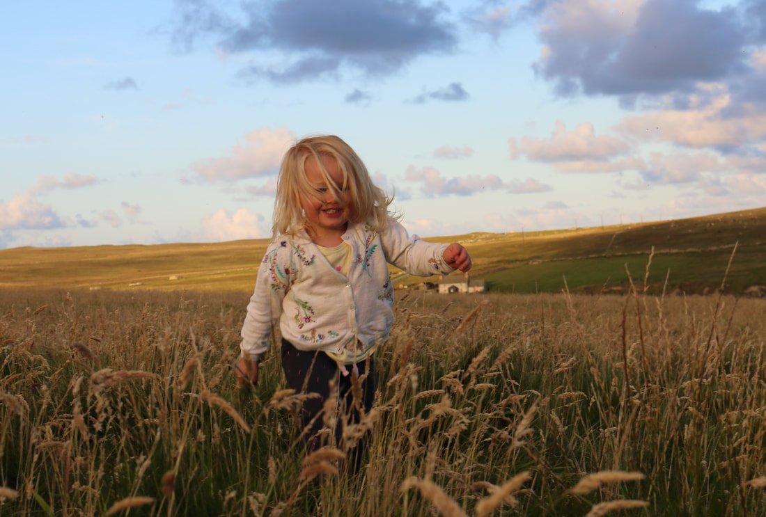
From the beach we headed west along the impressive coastline, through golden fields which shone against the low, setting August sun. The bairns ran free, bare legs jumping from knowe to knowe with hair shining in the sun and echoing the colours of the landscape. It all felt very earth-motherish until they started fighting and shergin' through over-tiredness.
Sunshine and freedom in the fields of Fetlar, Shetland.
Lena enjoying the sunshine and the freedom. I know this will remain a favourtite photo of childhood encapsulated.
We then followed the coast, in search of the Viking boat burial. Reputed to be the final resting place of a Viking man who had washed ashore during a storm, the crew were all washed away and this one remaining man asked that upon his death, he be buried with his boat and treasure. When he died, his wishes were honoured and he was given a Viking boat burial.
Time Team excavated the site (often referred to as the Giant's Grave) in 2002 and they discovered a great number of iron nails but no skeletal remains were uncovered.
Tortoise-shaped brooch now in Shetland Museum.
Unfortunately the site appeared to have mostly been robbed of its contents, however a beautiful 9th-century tortoise-shaped brooch was discovered indicating that this may in fact have been a Viking woman. Not much remains to be seen of the grave other than a quarried mound with a number of scattered stones within.
Walk 3
- Airstrip to Haltadans stone circle
(this took a while as we stopped for a picnic but the walk itself was short and could be achieved there and back within an hour).
For this walk we headed inland, leaving the coast behind us, into the hills and the land of the mythical trows and njuggels. We parked at the now disused airstrip, built in 1972, the gravel runway is now only used for emergencies and training purposes.
Haltadans, believed to date to the Bronze Age, is a circle of 38 stones with two positioned upright in the centre of the ring. This was our mission, to find it, and making our way north from the airstrip beyond Skutes Water, across the boggy moorland we saw a number of skootie Alans (Arctic skuas) with their distinctive pointed tail feathers. I wondered if the loch took its name from these birds or was it some other obscure etymological explanation?
Haltadans, or the Fairy Ring, wasn't that easy to find, with heather covering many of the stones it was difficult to pick them out in the blanket moor landscape. The OS map was handy to have on hand and thankfully skootie Alans are much less aggressive than their larger cousin, the bonxie (great skua) which made our passage easier. Despite this, we found the circle (eventually) and after some head-scratching, agreed that this was the spot of the famous fairy ring.
Haltadans stone circle, Fetlar, dating to the Bronze Age, often referred to as the Fairy Ring.
Haltadans stone circle dating to the Bronze Age, often referred to as the Fairy Ring.
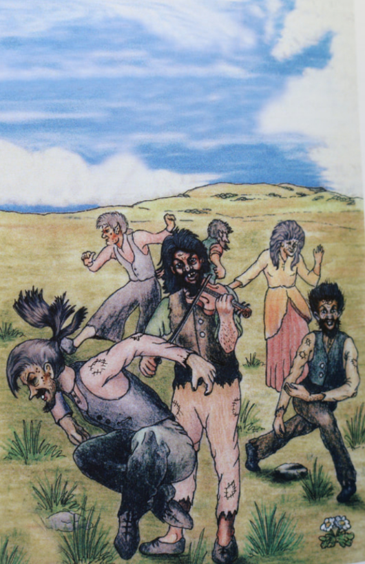
This unassuming stone circle has a number of folklore stories associated with it. One suggestion is that the circle represents a fiddler and his wife (the central stones) and the surrounding stones are trows (trolls) who, whilst dancing, were startled and turned to stone with the rising sun.
Trows, popular in Shetland folklore were said to be a cheerful and mischievous race who had a great love of fiddle music. The name Haltadans, according to etymologist Jakob Jakobsen referred to the fact that in Shetland folklore and tradition, trows and fairies were often said to limp when they danced and the expression "to had (hold) a haltadans" or "to rush about noisily" was still an expression used in Fetlar and Yell, noted, by Jakobsen when he published his place-names book (1936). Further evidence of this fiddling idea can be found on the OS map of the area which notes the Fiddler's Crus cairn just a short distance NW of the circle.
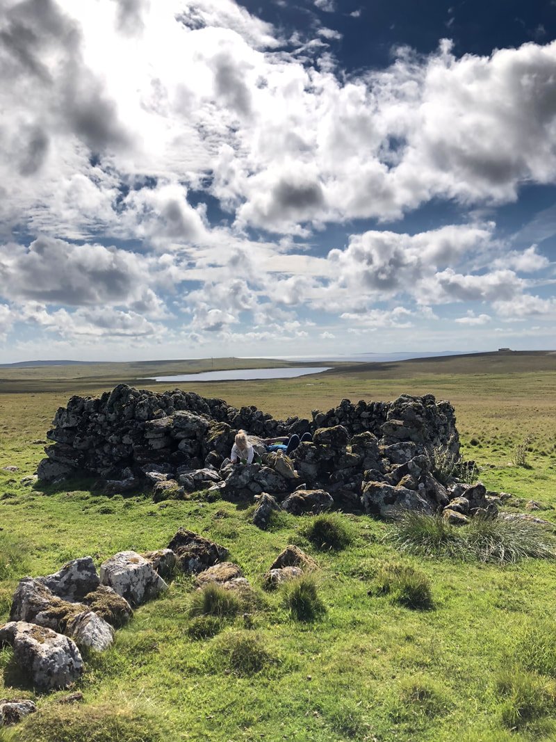
This part of the island feels very old, and steeped in history. There is little evidence of modernity as you pass through the moor, which in places reveals ancient boundary walls and cairns, including Finnigirt or the Finns Dyke. The lack of evidence of human habitation in itself is a rarity today, where even the most remote corner usually has a wire fence or telegraph pole nearby. Before we headed back to the car, and civilisation we spent a sunny, sun-drenched half-hour in an old plantiecrub (stone enclosure) having a picnic.
Quite possibly the perfect picnic spot? A plantiecrub in the hills.
A few other points of interest:
There are many more fantastic walks to take on Fetlar, and certainly plenty for the walker without young children. The coastline offers an ever-changing panorama and more information can be found in Peter Guy's, Walking the Coastline of Shetland: The Island of Fetlar (No. 3).
Houses and Haa's
One thing that struck me immediately was that there are many grand historic houses in Fetlar. Once supporting a large population, the fertile island boasted some of Shetland's grandest homes, and some remarkable characters too. In part one of this blog I looked at Smithfield Haa and the round-house at Gruting, and below a few more are outlined, although this is not an exhaustive list.
Brough Lodge
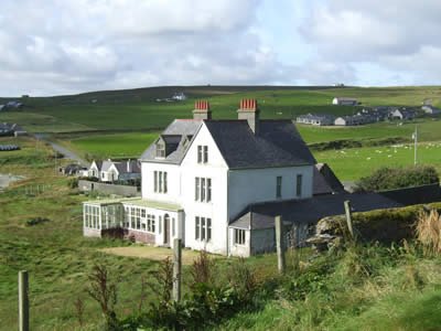
Brough Lodge, home of Sir Arthur Nicolson.
Brough Lodge is a very unusual house and unlike anything else built in Shetland. It was built in 1820 by landowner Sir Arthur Nicolson of Lochend (who we heard about in part one). This striking building was designed and built in a Georgian gothic style, in stark contrast to the Haa of Smithfield for example (part one) which was built at a similar time (1815). Brough Lodge had everything a grand house of that time should. It boasted, among others, a drawing-room, library, butler's pantry and a counting room (where the landlord dealt with the rents from the island), and it also had an astronomical observatory (obviously). The house was last inhabited in the 1970s. Sir Arthur was an eccentric man, who also built the roundhouse, his folly, at Gruting (again, discussed in part one).
Astronomical observatory at Brough Lodge.
Sir Arthur Nicolson's folly at Gruting.
Leagarth House
Leagarth House, built in 1901 by Sir William Watson Cheyne. Photo: © Fetlar Interpretive Centre
Another grand house is that of Leagarth in Houbie. Built in 1901 by Sir William Watson Cheyne who, along with Lord Lister, went on to develop safe antiseptic surgery methods. Lister realising that many infections prevalent in the 19th century were spread by bacteria, set out to change the way in which infection control was viewed at that time, especially in regard to surgery. Lister realised that by keeping bacteria out of wounds both before and after an operation, bacterial infection and death could be prevented.
William Watson Cheyne. Photo: © Fetlar Interpretive Centre
The young William Watson Cheyne, at Edinburgh University, an enthusiastic student to Lord Lister's became his House Surgeon, helping to develop an antiseptic solution to keep bacteria out of wounds. This really was pioneering work at the time and research which we are still grateful for today. The Fetlar Interpretive Centre has excellent displays on Sir William Watson Cheyne and opening hours are available on their website here.
Bay at Houbie, where Leagarth overlooks with pier.
Steps built by Sir William Watson Cheyne to encourage trouts to breed in the burn.
Tresta
Tresta is a place to note for its beauty and is situated in the heart of the island. The area is dominated by the spectacular beach with Papil water behind. When we went initially, the beach was narrow and rocky, but arriving in the early evening, a few hours later the beautiful sandy shores were revealed, offering a large expanse of beach with the spectacular cliffs of Lamb Hoga to the west. Nearby is the Kirk which was built in 1790 and has memorials to both the Nicolson's and Cheynes as well as several graves from the Second World War.
The Fetlar flit-boat at Ugasta.
One of the saddest sights for me, was the old Fetlar flit-boat at the Ugasta pier, just a stone's throw away from Brough Lodge. It lay in its noost above the high-water mark, still tied to the winch, as it was when it was hauled up for the last time.
Flit-boats were common in Shetland before the extensive road system was introduced, and sixerns (six-oared) like this were a common sight around Shetland shores, ferrying people, passengers and mail throughout the islands.
I found it quite poignant to see the knot, still holding the boat in place to the winch, secured against weather and tide, and I wondered whether the hands tying her up that last time knew that this would be her final resting place?
And on that note of reflection (it is a Sunday after all), I think I've said enough. Fetlar was a real treat and there is so much more to see, do and discover. I hope that this has given you a taste of the island and a reason to visit.


