Culswick Broch walk: Shetland's West Mainland
Culswick broch in Shetland's West Mainland.
Walk distance: 3 miles (4.6km)
Time taken: 3 hours
The walk is a total of 3 miles (4.6 km) and we did it earlier this year by bike, but probably only at a walking pace (bearing in mind we had a two and six-year-old in tow). It’s an excellent walk and I would allow an hour each way with an additional hour for exploring the ruined houses of Sotersta, as well as the broch and spectacular coastline along the way – so to enjoy it, allow three hours from start to finish.
The beautiful Culswick Valley.
A few miles from Skeld, Culswick is a dramatic, lush valley, forking into two with a bog in the centre, separating the east and west side – at the head of the valley, a storm beach now blocks the sea from entering the sheltered confines, or basin, into what would have been a sea loch (or flooded landscape).
Houses are scattered on either side; childhood haunts with familiar and friendly faces. I spent many a happy day in Culswick, and it brings back tremendous memories whenever I have the pleasure of visiting. As bairns, we were always warned away from its boggy soft-centre. Confined to the slopes, we had fun nonetheless and spent many a summer evening camping; tucked in under the hills, cocooned in a womb of endless summer, the world beyond us forgotten.
Mother will kill me for this but, – on the night that Nostradamus proclaimed the world would end – I remember it vividly, Magnie brought out his gramophone to play, while mam was tearfully mourning the end of the world in our tent, unable to sleep for fear that it was her, and our, last night on earth. Sweeping my two sisters and me tight into her chest, I remember trying to console her. Thankfully the predictions of Nostradamus (and mother) never materialised, and the sun rose again.
A sweet microclimate, some of Shetland’s best gardens flourish here under the glacially sculpted slopes which shelter it from the worst of the weather and the world beyond.
Parking for the walk to the Culswick broch - look out for the red phone box and signs for Methodist Chapel.
For the walk, we parked beside the iconic red British phone box which seems to be in the middle of nowhere. We made our way up the hill to where the small Culswick Chapel sits, this tiny methodist kirk still has services (although not weekly), and the annual carol evening is a firm favourite for people throughout Shetland who want to soak up the atmosphere of this peerie place of love and worship.
The walk is well marked and visitors can follow the track that leads to the broch. (Remembering to leave gates as you find them).
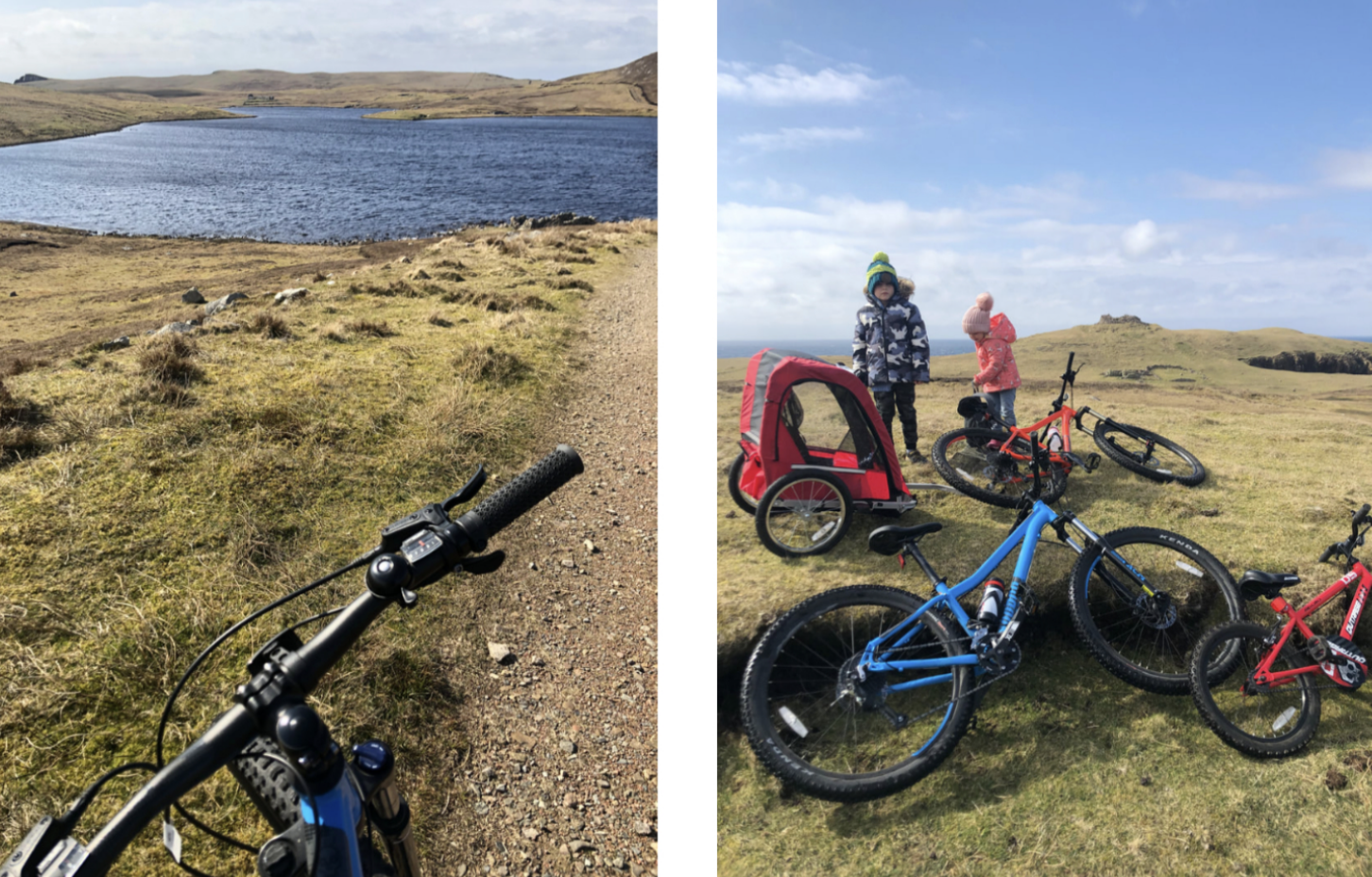
The walk, or cycle (we used mountain bikes, and I wouldn’t recommend anything other as the road is rutted and uneven), is moderately easy and passes through moorland, skirting the Loch of Sotersta before winding its way up the hill where the Broch and the Loch of Brough come into full view. It’s worth taking a little detour down to the abandoned township of Sotersta where the houses now stand roofless and soak up the atmosphere of this once thriving community.
Sotersta.
Despite the track taking you across the moor, the landscape doesn't disappoint. Dramatic and rugged; I always try to imagine how people from this unforgiving and exposed corner of the west mainland eked out a meagre living on this windswept plateau.
Plantiecrubs (small stone structures for growing young cabbage (kale) plants) still stand; a nod towards a crofting past here, a time of industry, hard work and bondage to the land.
Today, look out for the moorland birds, the laverock (skylark); lapwing and shalder (oystercatcher) are all abundant here. And look out for the whaap (curlew); endangered around the UK but thriving here in Shetland. As you get closer to the coast, try to spot the fulmars, shags and other seabirds.
Views from the saddle. At the end of the track we abandoned bikes and walked to the broch pictured on the right.
At the end of the track, we abandoned bikes and made the final ascent on foot. Passing over a stone causeway that slices through the Loch of Brough, the last leg doesn't disappoint. The spectacular views that greet you at the top ensure that the final effort is totally worth the throbbing knee-burn to get you there. Take a breath halfway up the climb, and admire the ruins of the house tucked into the lee, nestled in the shadow of the past. The house was built from stone taken from the broch that overlooks it, and now also sits in ruin, representing another strand of the rich history here.
The causeway that leads to the broch. Note the ruined house below the broch, built using stone from the broch.
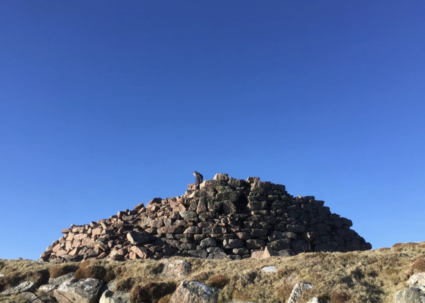
The broch, like many others, has collapsed and been robbed of most of its stone, although the walls can be clearly seen and still stand several metres high in places. The impressive ramparts, internal chambers and a massive triangular lintel stone above the doorway are also still visible, and on a day of chill easterly wind, the remaining interior was a welcome break from the elements to enjoy a quiet picnic.
The magnificent remains of the Culswick broch with its red granite stonework set against a March sky.
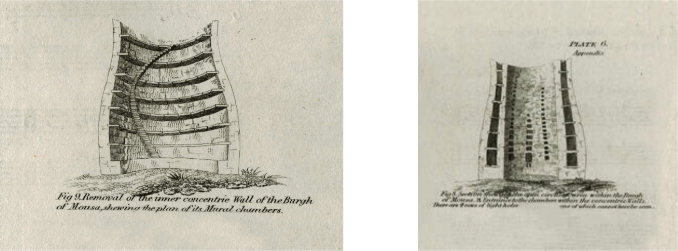
‘What is a broch?’ I hear you cry! A broch, in simple terms, is a round, stone structure which is constructed using two drystone walls – an inner and outer – with a staircase built between the two to reach the top. They date to about 2,000 years ago, the mid-Iron Age, and are unique to the north and west of Scotland. We have about 120 of them here in Shetland – most lie in ruin (and Mousa is the best example in the world. You can read about that here). Archaeologists still dispute what they were used for – whether they were defensive or offensive; or were they storehouses, or high status ‘manor houses’ of local chieftains? We don’t know. All that we can be sure of is that they are shrouded in mystery, and carry so much intrigue about past societies and how people lived and worked here in Shetland.
What is a broch?
It's a wonderful way to while away an afternoon, and here in Shetland, we have the right to roam so permission to walk to the broch is not required from a landowner, provided you respect the countryside code: don't worry animals, leave dogs on a leash, take your rubbish away with you and remember to leave gates as you find them.
With love,
Laurie x


